Source: National Oceanic and Atmospheric Administration
Flood Inundation Mapping Reaches Portions of Midwest
Sep 16, 2025, 12:17 PM CT
Share
MADISON, Wis. (CIVIC MEDIA) – New capabilities show river flooding forecasts with water appearing on a map, allowing the NWS to warn specific locations.
“Flooding is the most frequent severe weather-related threat and our costliest natural disaster,” said David Vallee in a press release, the director of Service Innovation and Partnership Division at NOAA’s National Water Center.
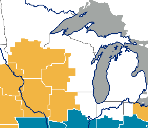
Now available for the first time in Wisconsin and Minnesota, this tool has been around for a couple of years. However, on Sept. 3, its use was expanded to 60% percent of the country. The tool is now available to portions of the upper Midwest and the Mississippi River Valley.
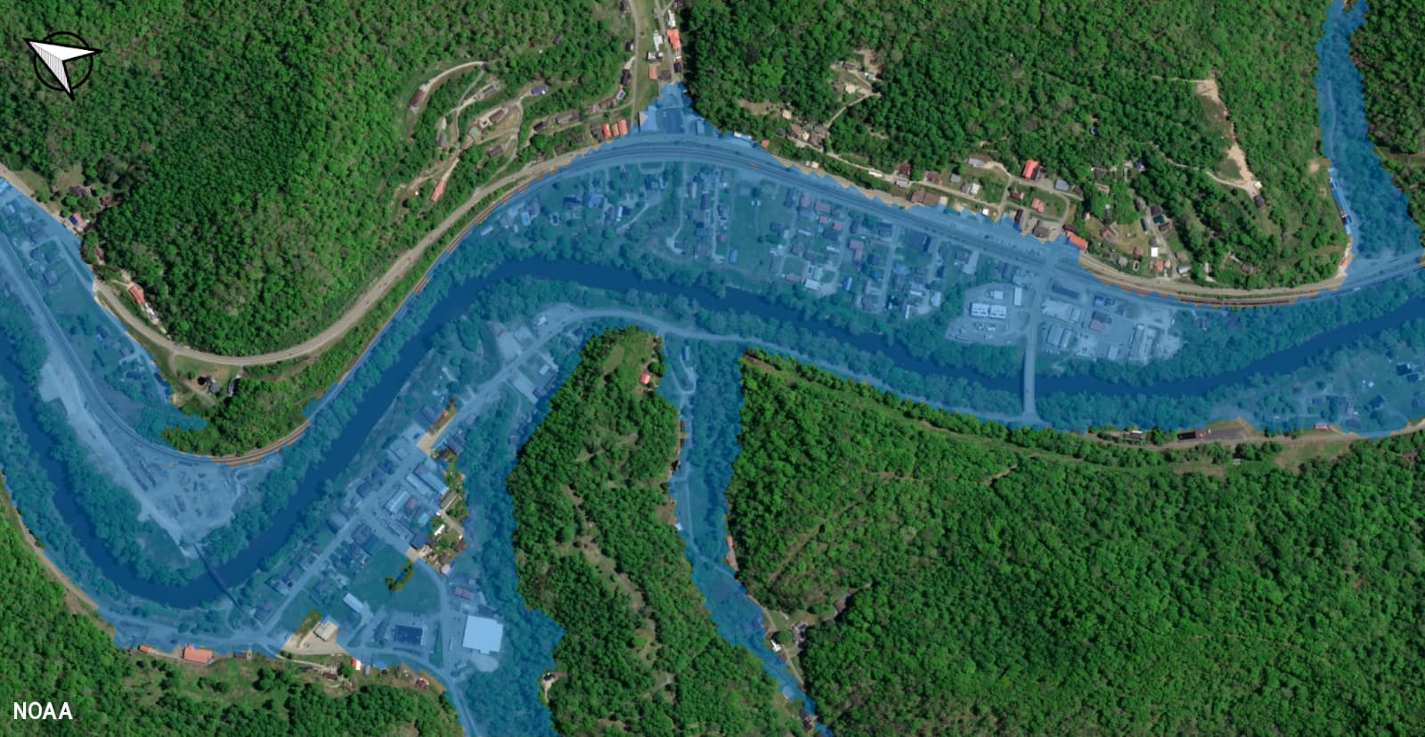
It provides near-real-time, high-resolution, street-level visualizations of flood waters to help NWS forecasters issue precise flood watches and warnings. These spatial estimates show what land may get covered with water for up to five days out. Hourly updates are also provided and analyzed, alongside river flow.
The program began in 2023 but only launched for 10 percent of the country. Louisiana, Texas, and New York were among the first users.
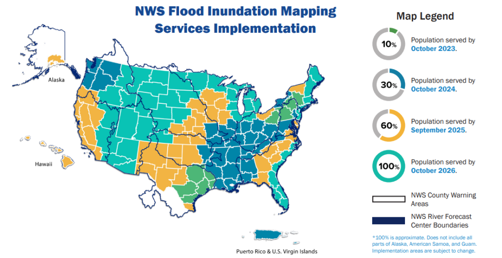
In 2024, it grew to cover 30 percent of the country and reached the eastern Great Lakes and Ohio Valley. In 2026, NOAA says FIM will be fully deployed nationwide and available for more than 3.6 million river miles covered by National Water Prediction model forecasts.

Brittney Merlot is Civic Media’s Meteorologist. Email her at brittney.merlot@civicmedia.us.
Want More Local News?
Civic Media
Civic Media Inc.
The Civic Media App
Put us in your pocket.
