
Source: Meteorologist Brittney Merlot
Dec 29, 2025, 10:52 AM CT
Share
MILWAUKEE, Wis. (WAUK) – Winds are whipping across the open waters of the Great Lakes, creating massive waves and a hazardous situation for ships and shorelines.
Waves are growing as tall as 35 feet, according to the National Weather Service, and could damage or capsize vessels.
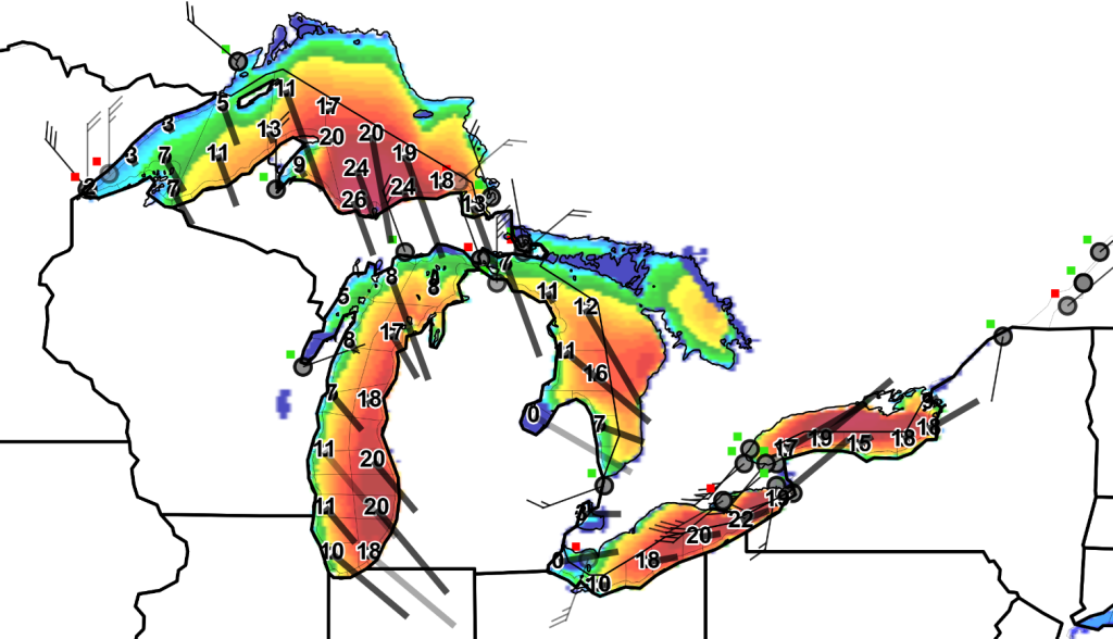
Wave are forecasted to reach nearly 35 feet on Lake Superior, 30 feet on Lake Michigan, 25 feet on Lake Huron, 25 feet on Lake Erie and 27 feet on Lake Ontario.
Winds are sustained 30 to 40 knots (35 – 46mph), with gusts reaching 55 knots (63 mph).
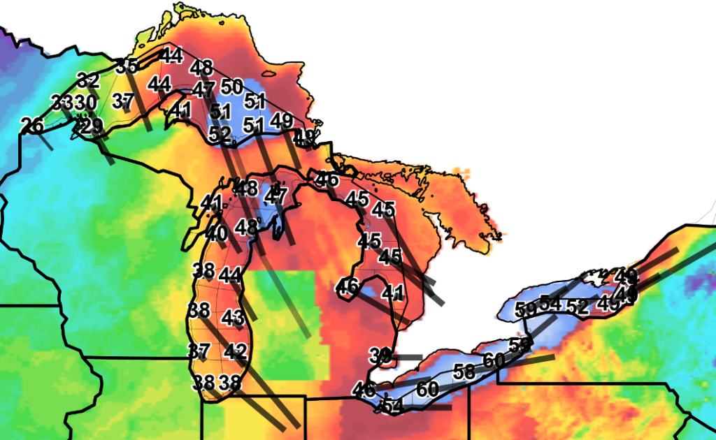
A Storm Warning is in effect for all lakes except for Lake Superior, as of Monday morning.
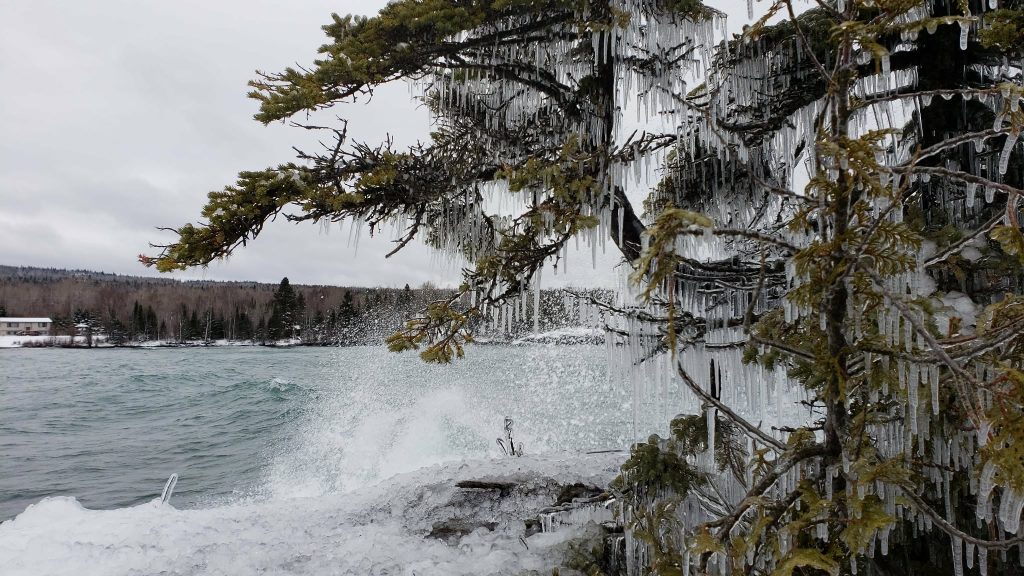
Gale Warnings are in effect on all five of the lakes through 9pm on Monday. So is a warning for Heavy Freezing Spray, which is accumulating on shores and ships, alongside reduced visibility with lake effect snow.
The Edmund Fitzgerald disappeared in these same conditions in 1975. A Gale Warning was rapidly upgraded to a Storm Warning (55–73 mph winds), which built waves up to 30 feet high on Lake Superior.
Winds are forecasted to diminish to Gale Force Monday night (39–54 mph) and ease even more, below Gale Force, by Tuesday morning.
If you are headed to the lakes to watch the waves, keep your distance. They likely contain rocks and debris and the power and the force of them could knock you down.

Brittney Merlot is Civic Media’s Meteorologist. Email her at brittney.merlot@civicmedia.us.
Want More Local News?
Civic Media
Civic Media Inc.
The Civic Media App
Put us in your pocket.
