Station Selected:

Share
MADISON, Wis. (CIVIC MEDIA) – Steady rain has improved the states drought conditions but its left farmers in a messy situation with deadlines rapidly approaching.
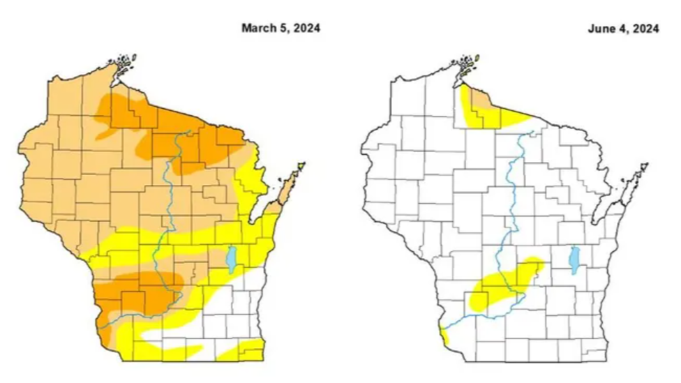
Only a year ago, local farmers were in the midst of a “flash drought.” Now, Wisconsin is 100% drought free but that’s not all good news.
Steady rain for the past month has left standing water in many farm fields, drowning young corn and soybean plants.
Last year a large dome of high pressure parked over Canada. This changed our summer to a hot and dry one.
This year, the jet stream has allowed systems to smack Wisconsin, over and over. Relentless activity with barely a break in rain, hay farmers did manage to have a successful first cut. Now the fields are green and good, waiting for a three day dry stretch to cut again.
But that is not the pattern this Spring has brought us. Instead, we’ve received over 5.5″ of rain in Madison so far this year. When at the same time last year, Madison hadn’t even picked up 1″ of rainfall yet.
Farmers are having a hard time getting their machinery through the muddy fields. To top it off, corn for grain has a deadline of this week. After that, farmers are going to need to consider corn for silage use or to plant soybeans. Not to mention, standing water leads to some crop diseases like stalk rot.
The problem is, farmers can handle short bursts of rain. Standing water for a day doesn’t do damage. But the week long puddles are the problem.
What’s ahead weather-wise next week is not good news.
It starts with Florida, seeing a record amount of rain. It’s all due to a Tropical Depression that has stalled over the sunshine state since Tuesday. Viciously soaking Miami with 20″ of downpours so far, canceling flights and stranding people in their cars.
Roads have turned into rivers and locals say its been worse now than hurricanes in the past. Another 5″ to 10″ is expected to strike Thursday.
This matters to Wisconsin, because that system is strong and eventually sliding up the east coast, leaving all other systems behind it with nowhere to go, except north…
This will build and surge in a “ring of fire” of heat and humidity that our state has not felt yet this year. Cue the air conditioning for Sunday on Father’s Day.
For the first time in 9 months, dew points will reach the mid 70s and stay there most of next week. This is an oppressive, sticky and humid airmass that has to potential to support excessive rain.
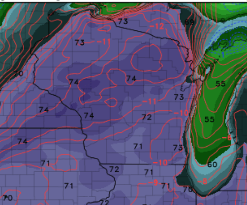
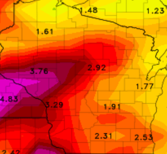
As temperatures tap the 90s on Sunday and stay hot into the week, showers and storms will drench us. Flash Flooding is expected in some areas, especially those who receive over 2″.
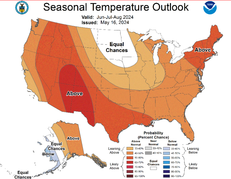
NOAA predicts that the rest of the summer looks near normal for rainfall amounts. Which for us, average is around 4″ of precipitation each summer month.
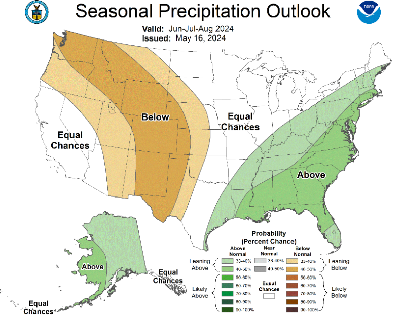
As for high temperatures, those looks to lean warmer than normal.
Despite the fact that we are supposed to transition into a La Nina pattern by August.