
Aug 18, 2025, 10:40 AM CT
Share
MADISON, Wis. (CIVIC MEDIA) – Soaking heavy rain returns, threatening Wisconsin with more flood risks.
Low pressure is headed through the state, dragging in high heat and humidity for the southern half of Wisconsin, as cooler air sits north.
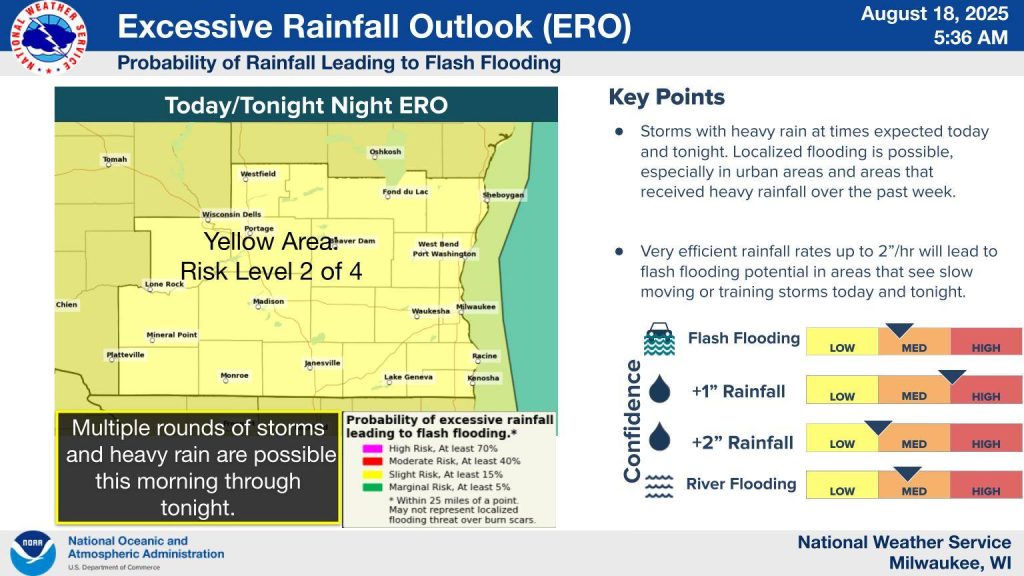
Thunderstorms that form, especially along the warm front, will pack the potential for extreme rainfall rates that could cause flash flooding.
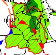
The National Weather Service warns that the potential for over 1.0″ of widespread rain is high.
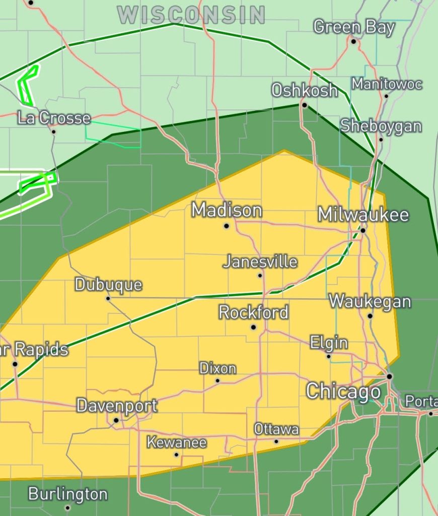
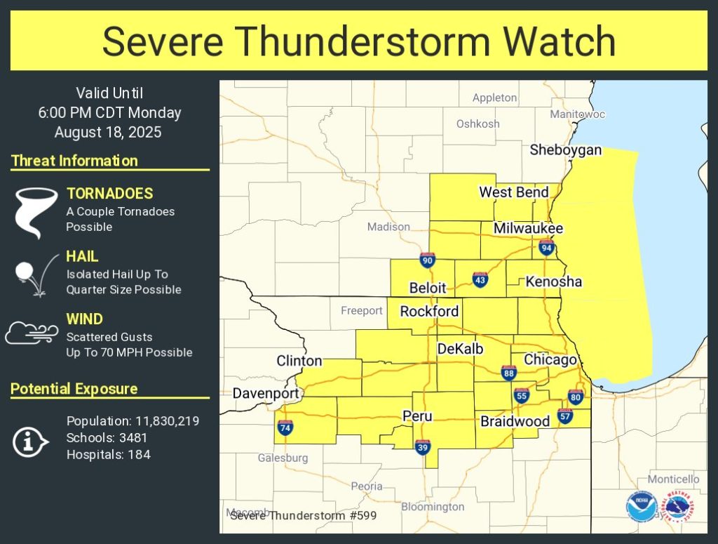
The Storm Prediction Center says some thunderstorms may also have high damaging wind gusts as well. A tornado or two is also possible, especially in areas south of La Crosse to Sheboygan.
A Severe Thunderstorm Watch has been issued and lasts until 6 p.m. for far southeastern areas, near Milwaukee.
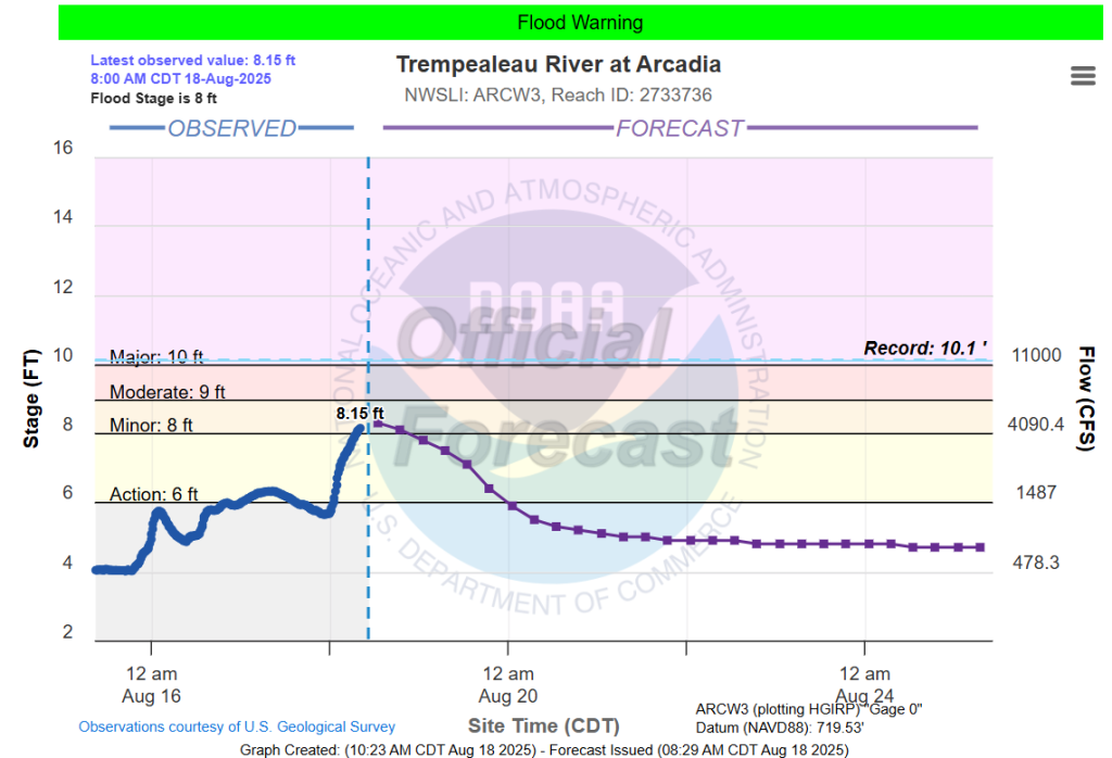
Rivers are high with the Trempealeau River in a Flood Warning at Arcadia. A Flood Watch is out further down stream at Dodge, where it’s expected to crest on Wednesday, August 20.
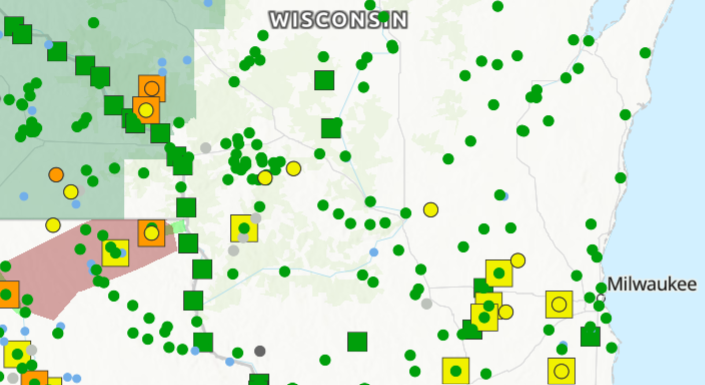
The Fox River at Waukesha and New Munster is still high, and it’s in and in an action level (yellow marks). The situation is the same for Rock River and Bark Rivers, too.
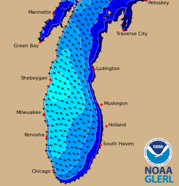
Meanwhile, there’s big waves on Lake Michigan. A Beach Hazard Statement is in effect until 3 p.m. Monday, August 18 for waves growing three to six feet high.
Rain will come in rounds, winding down overnight. A few spotty showers may linger into early Tuesday, August 19. Then, a dry stretch settles in for a few days.

Brittney Merlot is Civic Media’s Meteorologist. Email her at brittney.merlot@civicmedia.us.
Want More Local News?
Civic Media
Civic Media Inc.
The Civic Media App
Put us in your pocket.
