Aug 15, 2025, 11:58 AM CT
Share
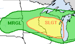
MADISON, Wis. (CIVIC MEDIA) – Weekend weather brings rounds of showers and storms that may be severe, threatening more damage and dragging flood risks back.
A front will slowly shimmy through the state, starting Friday afternoon, August 15 and not leaving until potentially Tuesday, August 19 around midday. Several rounds of heavy rain and thunderstorms are expected in the Midwest.
There’s potential for strong to severe storms that could punch with high damaging winds and hail, along with flooding.
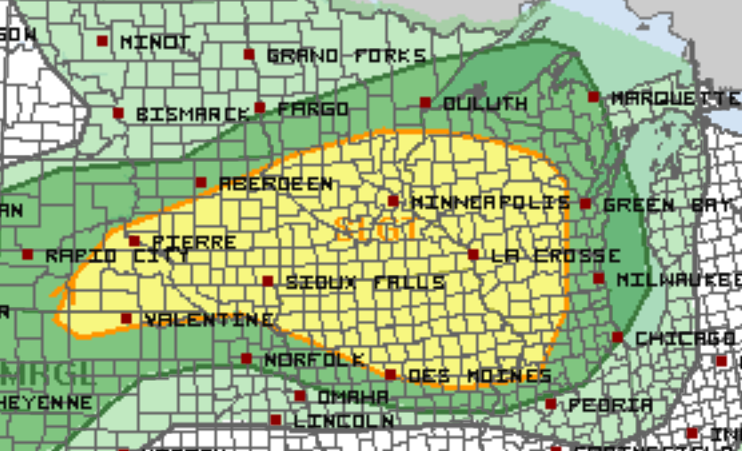
Saturday morning, August 16 through midday, a strong line of storms is forecasted to swing though the state. Behind that, temporary relief may be coming up north.
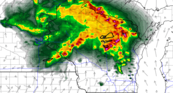
Scattered heavy thunderstorms are currently forecasted to then shoot south through Saturday afternoon and into the evening.
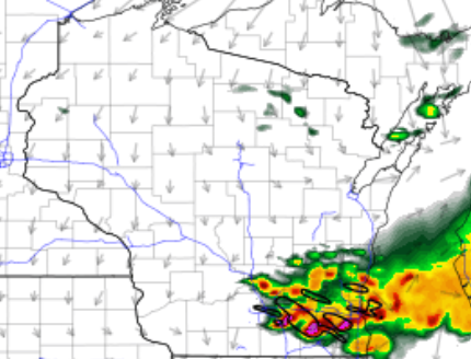
Then, rain looks to line up on a stalled front overnight, continuing into Monday, August 18 – areas under it may see flooding.
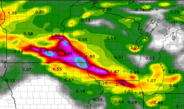
At this point, rainfall totals could be piling up to near 2-4″ in some spots.
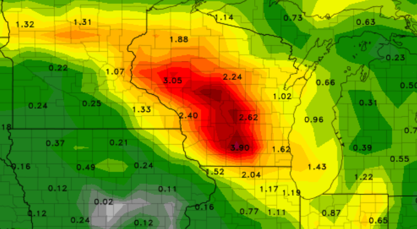
There is still uncertainty on where or if the front will stall and create excessive rainfall, training showers or storms over the same areas.
It doesn’t stop there either: the next wave of widespread rain moves in Monday, especially in the north, leaving scattered showers and lighter rain chances into Tuesday.

Brittney Merlot is Civic Media’s Meteorologist. Email her at brittney.merlot@civicmedia.us.
Want More Local News?
Civic Media
Civic Media Inc.
The Civic Media App
Put us in your pocket.
