
Source: Jennie Brand / Civic Media
In photos: Flooding in southeastern Wisconsin
Civic Media correspondents captured scenes from the deluge.
Aug 13, 2025, 6:20 PM CT
Share
From submerged sculptures to collapsed public roadways, communities throughout southeastern Wisconsin are bearing the costs of historic rainfall.
Civic Media correspondents Jennie Brand, Dan Shafer and Stuart J. Wattles were on hand to witness it.
Water gushes in Waukesha
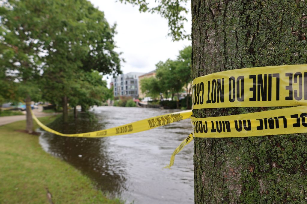
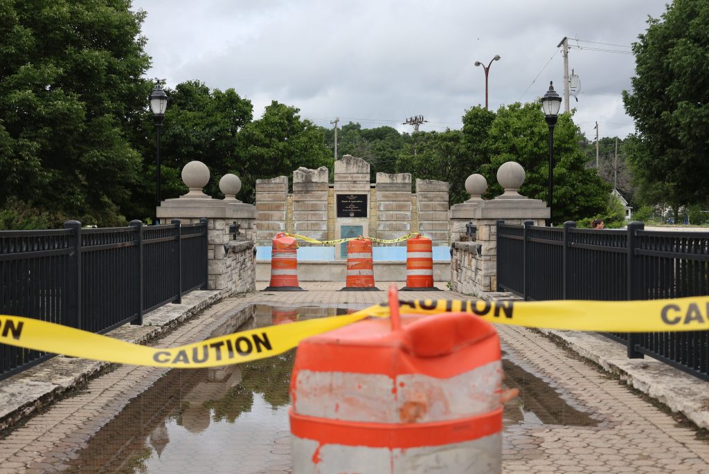
On Tuesday, gushing waters along the Fox River in historic downtown Waukesha showed no signs of slowing down.
Jennie Brand / Civic Media
Multiple bridges and surrounding roads remained closed to traffic, leaving the usually lively pathway accessible only on foot. Yellow tape hugged the riverbank, warning onlookers to stay away from pedestrian bridges and River Walk ramps still threatened by the cresting river.
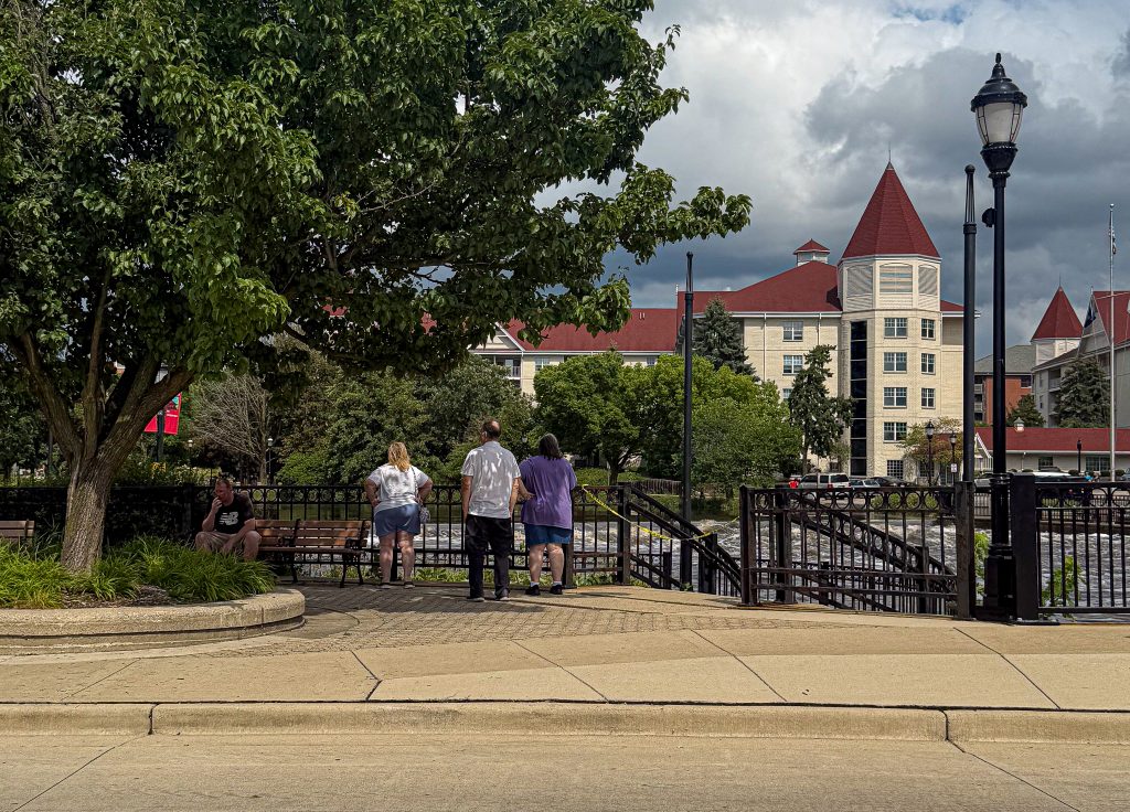
Some residents carried on with their day. Teenagers fished off the Barstow Street bridge; others rode bicycles on accessible sections of the walkway. Most made their way to the area to capture photos and videos of their own.
Flood levels of the Fox River underneath the bridge have been flirting with historic highs, according to data from NOAA’s National Water Prediction Service. Floodwaters near Barstow Street Bridge reached 8.58 feet on Monday, just shy of a historic high of 8.8 feet in 2008.
Jennie Brand / Civic Media
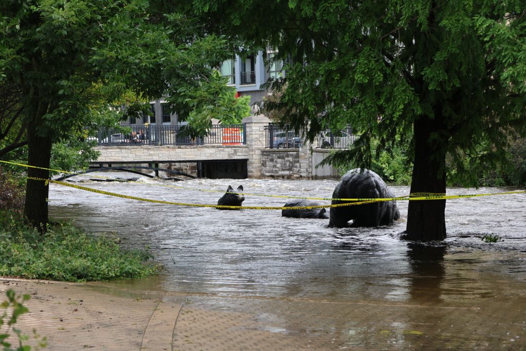
Areas of the walkway closest to the river remain littered with debris as water engulfed the city’s treasured Three Bronze Bears sculptures. Usually set on dry land, the bears now look like they’re fishing for food and served as a stark visual indicator of the river’s rise since it experienced historic rainfall on Aug. 9.
Totals from flash flooding in Waukesha County exceeded 7 to 10 inches, according to the Wisconsin State Climatology Office.
Jennie Brand / Civic Media
— Jennie Brand
Roads give way near Menomonee Falls
Nearby in Menomonee Falls on Tuesday, two roads had collapsed from the flooding. In one instance, one road collapsed underneath a driver, reports WISN 12.
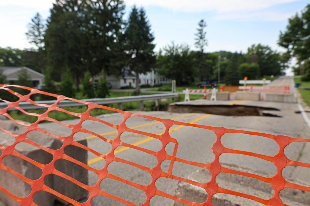
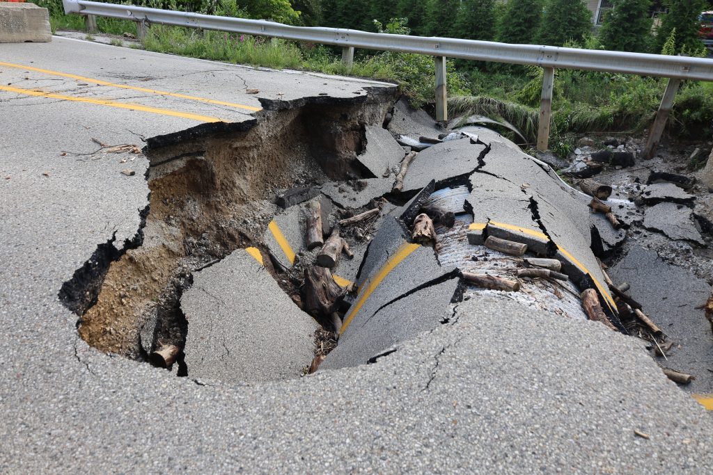
— Jennie Brand
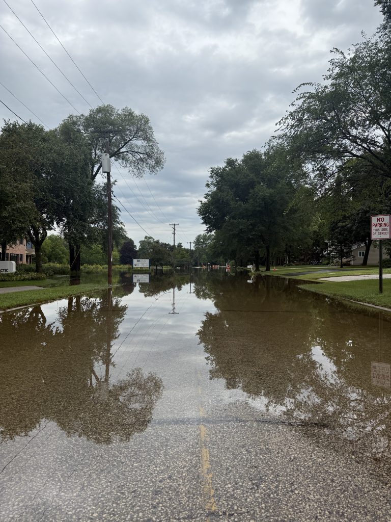
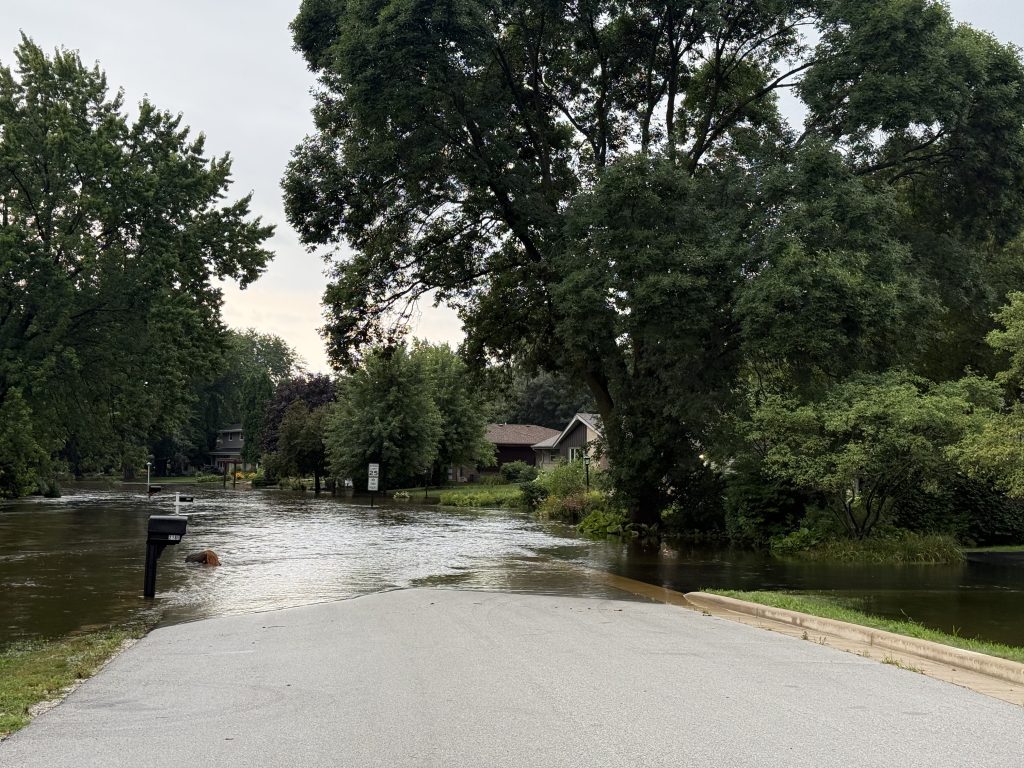
In Germantown, residents evacuate (voluntarily)
Twenty-five minutes northeast of Waukesha on Tuesday, there’s an unlikely sight in Germantown: a firetruck spraying more water into the floodwaters.
They were doing so to move the water into the street, so it could re-enter downstream.
Floods made some roads impassable, but it didn’t stop determined drivers from grabbing lunch in the Arby’s drive-through.
As for how long the flood would last? At least several days, said Fire Chief John McLain during a press conference outside the Comfort Inn & Suites.
“The last time we had any major flooding was in 1997, but a lot has changed since then,” he added.
The police department was conducting welfare checks on homes in the Riversbend Circle subdivision, and people entering needed to prove that they were residents.
In the flooded portion of the subdivision, residents were encouraged, but not required, to evacuate. Just south of the subdivision are several chain restaurants, a gas station, an office building and a Comfort Inn, many of which were closed or had entrances and exits blocked as the city managed the flood waters, which stretched across County Line Road, just west of Interstate 41.
The deepest waters were near a corner of Riversbend Ln. and County Line Road, near a Panda Express.
Much of the vehicle traffic was being directed away from the area, and while warm temperatures and sunny weather was keeping some paved surfaces dry, several inches of pooled, standing water covered many of the roads and parking lots over several blocks.
— Dan Shafer
Debris builds up in Wauwatosa
In Wauwatosa on Monday, a day after the Menomonee River here reached a flood level of more than 14.5 feet, debris was piling up and the Menomonee River was still rushing at near-record levels in Wauwatosa Village.
Two people were rescued after falling into the Menomonee River, while trying to rescue a dog. The dog was also later rescued.
County Executive Paul Farrow declared a State of Emergency, and residents were directed to a disaster information page.
An “unheard of” number of calls in Milwaukee
In Milwaukee on Monday, Milwaukee Fire Chief Aaron Lipski told The Maggie Daun Show that the nonstop, heavy rain far exceeded forecasts, forcing his department to completely change the way it operates.
Firefighters and rescuers handled over 600 calls between 8pm Saturday and 7am on Sunday, something that Lipski says was “unheard of.”
In Milwaukee on Sunday, Milwaukee County Executive
David Crowley had declared a State of Emergency, reports Stuart J. Wattles.
Milwaukee flooding resources:
The Red Cross is operating shelters at Holler Park (5151 S. Sixth St.) and Washington Park Senior Center (4420 W. Vliet St.) to help those forced from their homes.
The city’s Department of Public Works has made two drop-off centers, located at 3879 W Lincoln Ave and North: 6660 NIndustrial Road, free-of-charge through Sunday, August 17. They are open 7am through 3pm.
Residents can report flooding, stranded vehicles, downed trees or limbs, traffic or street light outages, and other issues by calling 414-286-CITY or visiting milwaukee.gov/Click4Action.
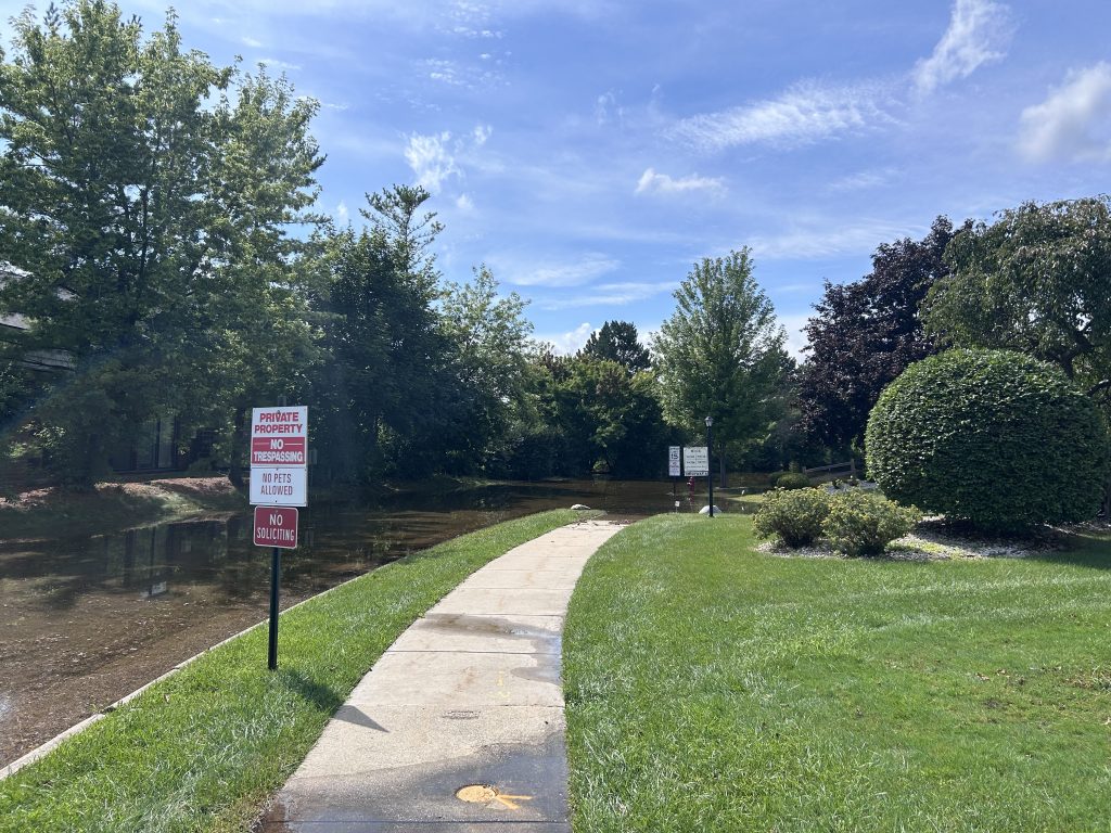
Flooding near Brookfield highlights local flood management initiatives
In the Village of Elm Grove near Brookfield on Sunday, Underwood Creek was overflowing.
Flood management had been on the minds of Elm Grove residents before this week. Last fall, voters here approved a referendum to “daylight” the creek, as part of flood management plans.
This article included contributions from Jennie Brand, Dan Shafer, Stuart J. Wattles, and editing assistance from Chali Pittman.

Dan Shafer is a veteran Milwaukee journalist, an award-winning weekly opinion columnist, Civic Media’s Political Editor, and author of The Recombobulation Area.

Stuart J. Wattles is Southeastern Wisconsin News Director and the voice of newscasts on WRJN and WAUK. Email him at stuartj.wattles@civicmedia.us.

Jennie Brand is Civic Media’s Community Manager, helping Wisconsites feel informed, represented, and heard. Reach out at jennie.brand@civicmedia.us.
Want More Local News?
Civic Media
Civic Media Inc.
The Civic Media App
Put us in your pocket.
