Historic Storm Rainfall Records Take Time To Vet
Aug 13, 2025, 9:07 AM CT
Share
MILWAUKEE, Wis. (CIVIC MEDIA) – The National Weather Service (NWS) releases more reports and are investigating the historic levels of rainfall with other state agencies.
Delayed reports come in from Jefferson County Emergency Management, from the storms on Saturday in southeastern Wisconsin: two hikers were hit by lightning and were injured. It happened on the Ice Age Trail in the Kettle Moraine State Forest. They were about a mile in on the trail when lightning struck a nearby tree. The lightning caused a ground current, which knocked both individuals unconscious.
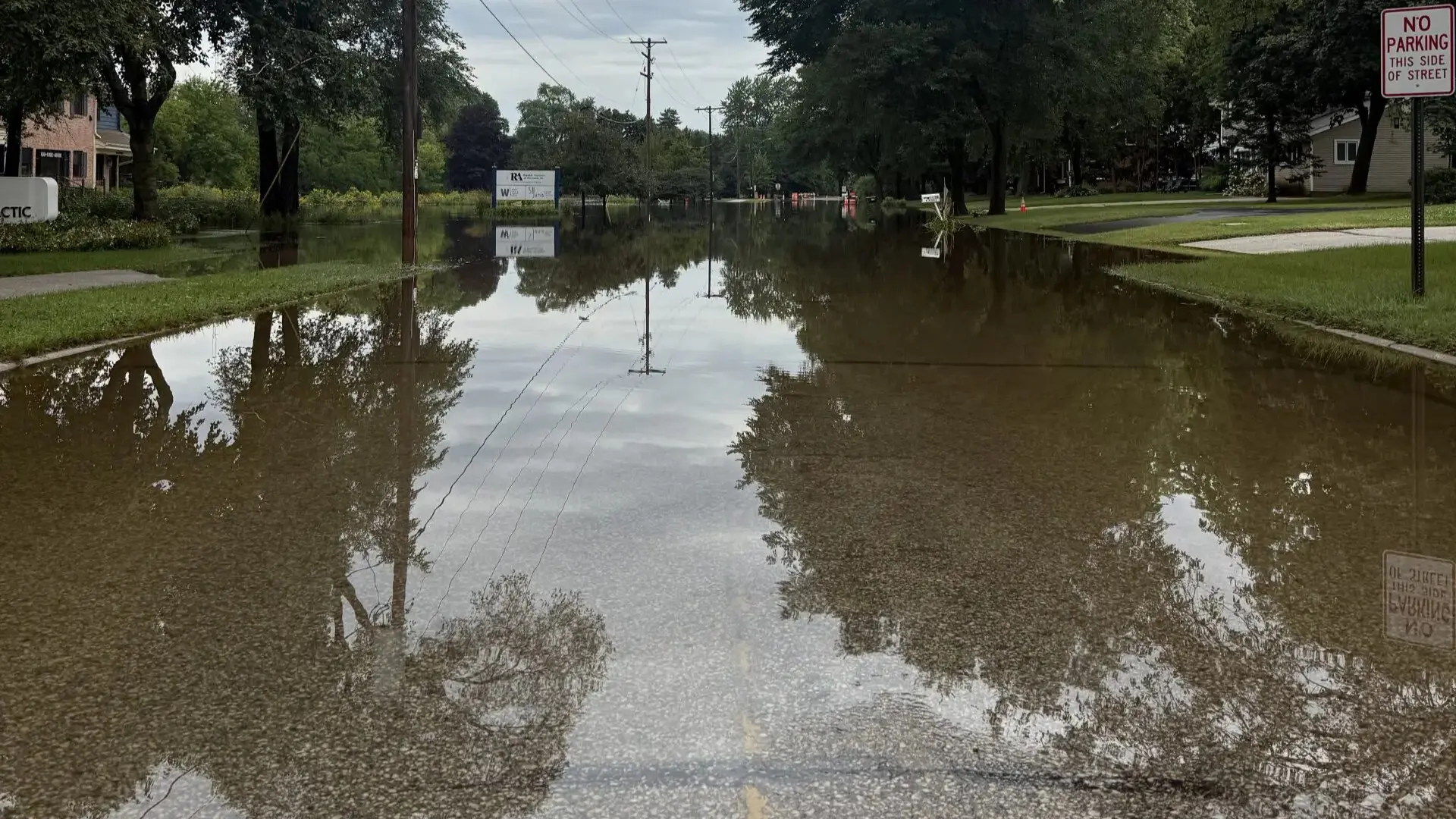
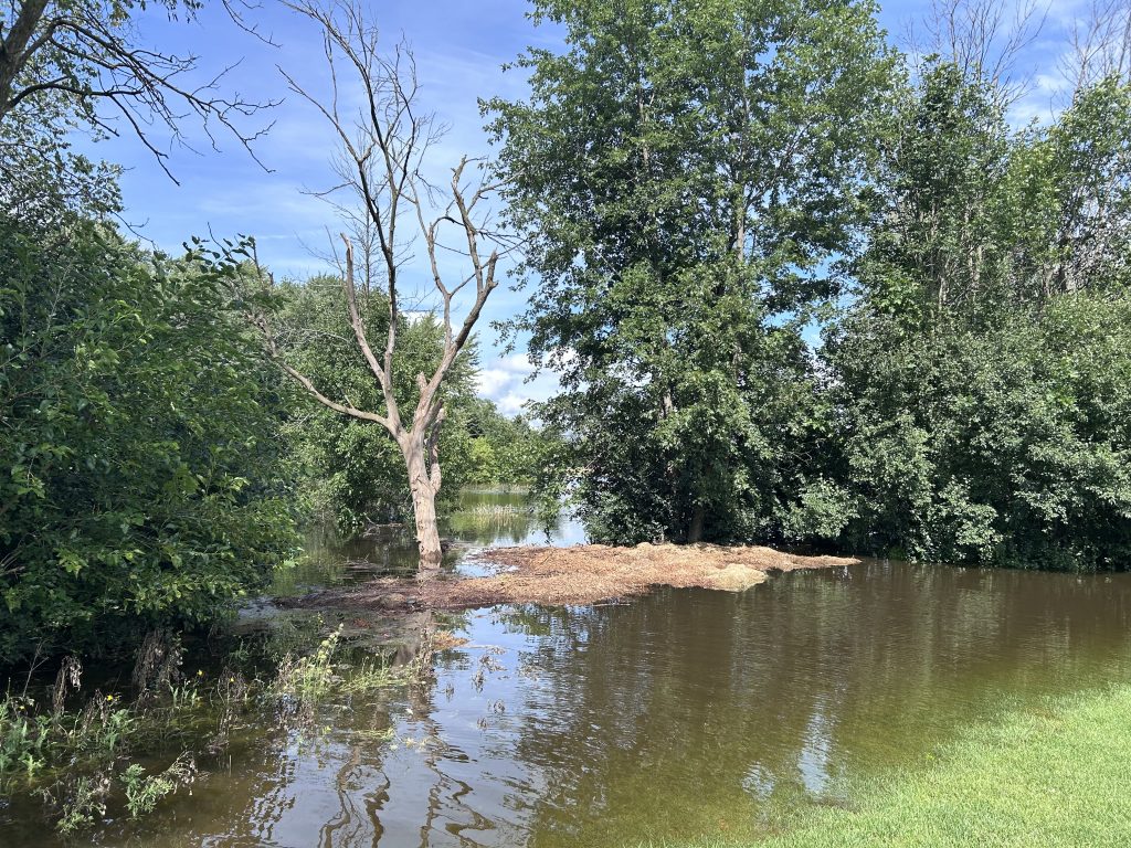
Flooding continues in many parts of southeastern Wisconsin from the rapid rainfall, causing rushing and rising rivers. Flood Warnings remain in effect on the Fox River at Waukesha and Cedar Creek at Cedarburg for moderate flood levels. The Milwaukee River near Cedarburg is also high.

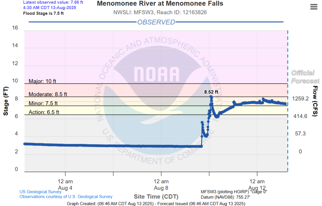
The Menomonee River hit historic levels. Its prior record height at Menomonee Falls was 8.31 feet on June 21 in 1997. This week, it rose to 8.52 feet Sunday night August 10, 2025.
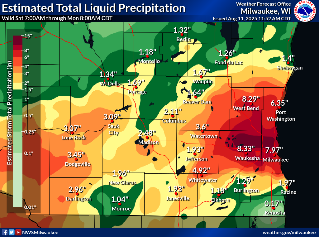
The National Weather Service Milwaukee/Sullivan is looking into a 24-hour rainfall record of 11.88 inches near Butler; Milwaukee Metropolitan Sewerage District also reported rainfall amounts of 14.50 inches. Either of those totals could be a state record. However, they need to vet the data, since no other reports were that high nearby MMSD. This process could take weeks to months.
If you remember in 2018 in Dane County, 14-15 inches of rainfall was rejected after review because the gauges were not sited properly.
Investigation into the totals is a collaboration between the NWS, state climatology, regional NWS, NCEI and MMSD.
The prior state record of rainfall in a day was in Mellen in 1946, with 11.82” falling.
For this event, two-day precipitation totals in Pewaukee reached 12.61″, Butler 12.22″, Menomonee Falls 12.05″, Milwaukee 11.71”, Germantown 10.58″, Hubertus 10.25″, West Bend 10.10″, Bayside 10.09″, Whitefish Bay 9.21”, Port Washington 9.19″, West Allis 8.94”, 7.99″ Wauwatosa.
This all happened as a well-defined outflow boundary set up from southcentral Wisconsin into the Chicago area from convection earlier in the day. Then, a screaming low level formed in the evening – it aimed directly over that boundary and dumped tropical moisture over them.

Brittney Merlot is Civic Media’s Meteorologist. Email her at brittney.merlot@civicmedia.us.
Want More Local News?
Civic Media
Civic Media Inc.
The Civic Media App
Put us in your pocket.
