
Heat Cranks Up, Dragging in Strong Storms and Flooding Risks
Aug 8, 2025, 11:29 AM CT
Share
MADISON, Wis. (WMDX) – Thunderstorms are in the batter’s box, ready to swing into the high heat and humidity that blankets Wisconsin.
Heat Advisories are issued for portions of the Fox Valley and places northwest in the state for Friday. Temperatures will soar to the low 90s and, factoring in the high humidity, it’ll feel closer to 100 degrees.
Low pressure will drape a cold front through the state starting Friday. Thunderstorms will be the theme of the weekend in Wisconsin. Hazards of flooding, damaging high winds and hail arrive this weekend as well.
Starting midday Friday, Superior, Hayward, Ashland and northeast Northwoods are in the bullseye. Another round overnight is expected as well. There will be some relief up north, with a dry weekend likely.
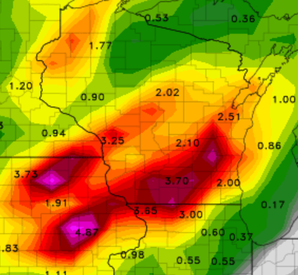
Meanwhile south in the state, the heat builds to the 90s again on Sunday. Central Wisconsin, Madison and Milwaukee has a shot at strong to severe storms that afternoon. Gusts could reach up to 70mph and rainfall totals could approach 3-5″ in some places.
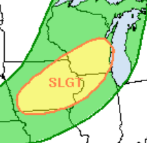
Current data suggests that the front will stall and sit over the southern parts of Wisconsin through Monday, sending more waves of rain and thunder. This is when flooding may become a big concern.
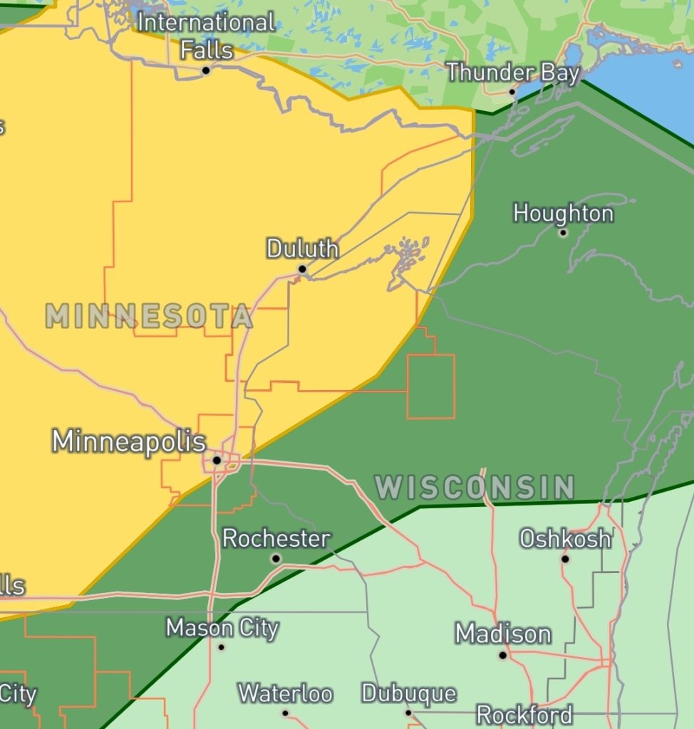
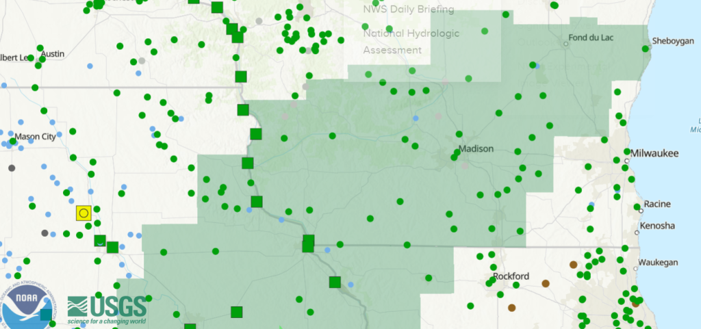
A Flood Watch starts Saturday 4 PM and lasts through Monday 7 AM.
Be sure to have an umbrella and rainboots nearby. Prepare for storms by getting flashlights and emergency gear in your safe place. Make sure you have a way to be warned, and stay weather savvy.
If you are planning to cool off from the heat in the water this weekend, there’s a moderate swim risk on Lake Michigan beaches. You’ll want to know, what drownings really look like, as rip currents and waves may rapidly grow in these conditions.

Brittney Merlot is Civic Media’s Meteorologist. Email her at brittney.merlot@civicmedia.us.
Want More Local News?
Civic Media
Civic Media Inc.
The Civic Media App
Put us in your pocket.
