
Cold Front Drags in Risk for Severe Thunderstorms and Tornadoes
Jul 16, 2025, 10:52 AM CT
Share
MADISON, Wis. (CIVIC MEDIA) – A 30-degree temperature spread across Wisconsin sparks threats for possible flash flooding, damaging winds and tornadoes.
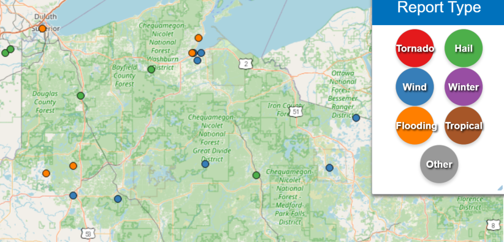
It started on Tuesday in the Northwoods – the front stalled across the region and produced a tornado warning near Park Falls. Flash Flood Warnings in at least 5 different cities went off after 1 to 4″ of rain fell rapidly. The town of Gordon reported 5.25″ of total rainfall. Hail was also seen in scattered spots, and 52 mph wind gusts were clocked in Ashland. Trees came down and knocked out power in Stone Lake, Lac Du Flambeau and the Presque Isle areas.
Today, Wednesday, the threat continues to move through the rest of the state. A low-pressure system is swinging in and dragging a cold front along with it. Temperatures are in the 50s up north and 80s south in the state. A quickly changing airmass from hot and humid to dry and cool, will spark strong thunderstorms in the afternoon.
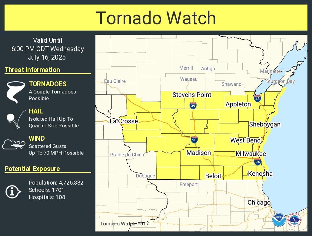
Risks of hail, damaging high winds and tornadoes are all possible.
Heavy soaking rainfall is expected, especially in central Wisconsin and into the Fox Valley. A rapid 2″ to 4″ is not out of the question; a Flood Watch has been issued by the National Weather Service and starts at 1 p.m.
Flash floods happen fast. Turn around, don’t drown. Cars can be submerged rapidly: it just happened in Chicago.
Stay safe and weather savvy. Have a plan in place now and ways to get notified if you are in the path of a dangerous thunderstorm.

Brittney Merlot is Civic Media’s Meteorologist. Email her at brittney.merlot@civicmedia.us.
Want More Local News?
Civic Media
Civic Media Inc.
The Civic Media App
Put us in your pocket.
