Civic Media
  • News

  • Shows

  • Stations
    • Radio Stations

    • Coverage Area

  • About
    • Get to Know us

    • Our mission, vision, values

    • Careers

    • Get in Touch

    • Press

    • Awards

  • Advertise

  • Support

  • Store

Civic Media

202 State St, Suite 200
Madison, WI 53703
608-819-8255
info@civicmedia.us

News Ethics and Standards | Privacy Policy

Youtube

Bluesky

X

Facebook

Instagram

LinkedIn

  • News

  • Shows

  • Stations
    • Radio Stations

    • Coverage Area

  • About
    • Get to Know us

    • Our mission, vision, values

    • Careers

    • Get in Touch

    • Press

    • Awards

  • Advertise

  • Support

  • Store

© 2026 Civic Media

WMDX

92.7 WMDX

Select to listen

0:00

WMDX

Something went wrong...

Cold Front Causes Storms, Washing Away Heat Advisories Soon

News,

Weather

•

1 min read

Cold Front Causes Storms, Washing Away Heat Advisories Soon

Meteorologist Brittney Merlot's profile picture
Meteorologist Brittney Merlot

Jun 23, 2025, 8:35 AM CST

Facebook
Instagram
Twitter
Reddit
Bluesky

Share

Facebook
Instagram
Twitter
Reddit
Bluesky

MADISON, Wis (WMDX) – After high heat and humidity had a grip on Wisconsin, the threat of severe thunderstorms now brings a risk of flooding alongside a cooldown.

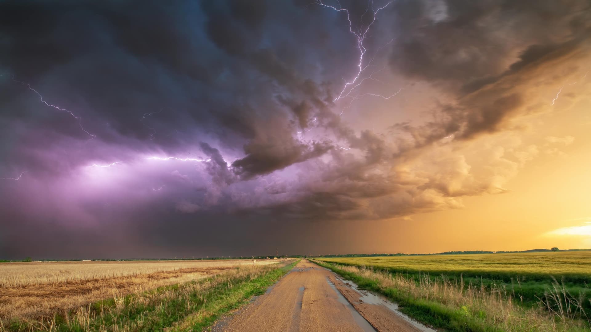
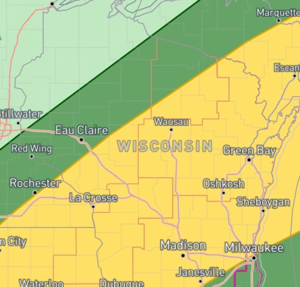
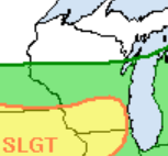
Strong thunderstorms will follow a cold front sweeping across the state. The Storm Prediction Center has put much of the state in a Slight Risk for severe conditions.

These storms will likely pack hazardous high winds and heavy downpours. Hail is also a risk, especially in the afternoon, and a tornado or two are possible.

Monday June 23, 6 p.m. Forecast

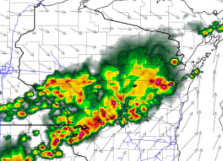
The wet weather starts around 1 or 2 p.m. in west-central Wisconsin and will grow northeast. As it works southeast through the state, it’ll go until dark, fizzling out near Milwaukee in the evening.

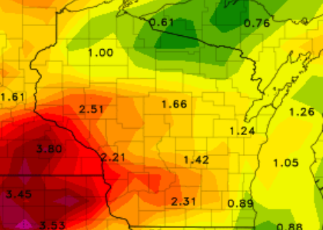
As the front stalls and sits over the state through the entire week, rain will drench us and has the potential of causing flooding in places. The Weather Prediction Center has put the area at slight risk for excessive rainfall.

Monday and Tuesday risk remains mostly south.

Then, the heavy rain should lift north for the latter half of the week. Shifting the increased rainfall and risk away from the southern state line.

Projected Rain Totals by the weekend.

You can check current river levels here.

National Weather Service
Brittney Merlot
Brittney Merlot

Brittney Merlot is Civic Media’s Meteorologist. Email her at brittney.merlot@civicmedia.us.

More from Brittney Merlot

Cold creates lake effect snow and thriving tourism

Thin ice on lakes, after warmer winter weather

Want More Local News?

We've got you. Scan it to get it.

Civic Media App Icon

Civic Media

Civic Media Inc.

Civic Media App Icon

The Civic Media App

Put us in your pocket.