
Scientists Predict the Most Aggressive Hurricane Season Ahead
Jun 3, 2024, 10:13 AM CT
Share
MADISON, Wis. (CIVIC MEDIA) – La Nina and warmer than average ocean temperatures are major drivers of tropical activity and an above average cyclone season forecast.
Snowbirds: Ones who travels to warm climates for the winter.
If you have property down south in the warmer southern states, listen up!
Forecasters at the Climate Prediction Center are predicting above-normal hurricane activity in the Atlantic basin this year. NOAA’s outlook for the 2024 Atlantic hurricane season, which spans from June 1st to November 30th, says there is an 85% chance of an above-normal season, a 10% chance of a near-normal season and a 5% chance of a below-normal season.
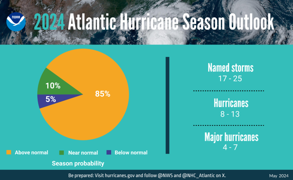
Scientists believe a range of 17 to 25 total named storms will occur, with winds of 39 mph or higher. Of those, 8 to 13 are forecasted to become hurricanes with winds of 74 mph or higher. They also think that 4 to 7 major hurricanes of a category 3, 4 or 5; with winds of 111 mph or higher is likely. Forecasters actually have a 70% confidence rate in this.
Why? Well it’s due to a few factors, including near-record warm ocean temperatures in the Atlantic Ocean, development of La Nina conditions in the Pacific, reduced Atlantic trade winds and less wind shear, all of which favor tropical storm formation.
This year was one of the strongest El Ninos ever observed and now it’s nearing its end. NOAA scientists predict a quick transition to La Nina conditions, which are conducive to Atlantic hurricane activity This is because La Nina tends to lessen wind shear in the tropics. At the same time, abundant oceanic heat content in the tropical Atlantic Ocean and Caribbean Sea creates more energy to fuel for storm development.
Light trade winds allow hurricanes to grow in strength without the disruption of strong wind shear, and also minimize ocean cooling.
Human-caused climate change is warming our ocean globally and melting ice on land, leading to sea level rise. This increases the risk of storm surge.
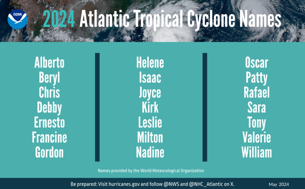
Here’s a look at this years cyclone names ahead.
About NOAA seasonal outlooks
NOAA’s outlook is for overall seasonal activity and is not a landfall forecast.
NOAA’s Climate Prediction Center will update the 2024 Atlantic seasonal outlook in early August, prior to the historical peak of the season.

Brittney Merlot is Civic Media’s Meteorologist. Email her at brittney.merlot@civicmedia.us.
Want More Local News?
Civic Media
Civic Media Inc.
The Civic Media App
Put us in your pocket.
